[2019 UPDATE: This post was published in 2017 and the material represents an early stage in my research into Lyttonsville’s history. A more complete history appears in the Talbot Avenue Bridge Historic American Engineering Record (HAER) report completed in July 2019. That document will be available to the public in 2020 via the Library of Congress website.]
INTRODUCTION
Just about the only thing Maryland-National Capital Park and Planning Commission’s Montgomery County Planning Department (M-NCPPC) architectural historians got right in the agency’s history of Silver Spring, Maryland’s, Lyttonsville community was that Samuel Lytton bought some property in 1853. Were it not for a sharp rebuke from longtime residents of the historic African American hamlet, the official history memorialized in a new sector plan would have read that Lytton was a “freed slave.”[1] That early draft historic context contained many factual errors, some of which were corrected before the Montgomery County Planning Board in late 2016 recommended approving the Greater Lyttonsville Sector Plan, which the Montgomery County Council approved in early 2017.
The final Lyttonsville historic context that is now part of Montgomery County’s background materials for formulating everything from development plans in the community to public art for proposed light rail line stations to place making efforts to historic preservation planning is an incomplete and error-filled narrative. Whether it’s the false assertion that Lyttonsville was a “pre-Civil War free black settlement” or the lazy conclusion that agency staff couldn’t find out what happened to Lytton’s property after his death, “It is unclear who owned the property when it was platted as twelve lots,”[2] there are significant issues with the M-NCPPC’s research.
This post explores some of Lyttonsville’s early history up to the turn of the twentieth century and fills in some of the many gaps left by the M-NCPPC staff research that is now Montgomery County’s official historic context for the community.
Samuel Lytton

There are no known images depicting Samuel Lytton.
Samuel Lytton is a historical mystery. He spent about four decades in Montgomery County and left only ephemeral evidence about who he was, how he made a living, and what motivated him to establish a basis for the development of the community that now bears his name.
Government documents give us a glimpse into Lytton’s basic biography. He was a Maryland native who was born c. 1830. In 1849 he married Phyllis Cosbery in Washington, D.C. Phyllis, born in Kentucky, was 20 years Samuel’s senior. It is possible that she was an enslaved member of Francis Preston Blair’s household who came to Washington from Kentucky with the Blair family. The following year a census enumerator documented him as a “laborer” living in Blair’s household in what is now Silver Spring. By the 1860 census, Lytton had established his own household in the four acre tract he had paid white farmer Leonard Johnson $96 to buy in January 1853.[3] Three years later, during the Civil War, Lytton registered for the newly enacted federal draft. The entry identified Lytton as a “colored” farmer who was married.
Samuel and Phyllis had at least two children together: Joanna, born c. 1852, and Alice, born in 1867. The 1900 census shows that the then 90-year-old widow had given birth to 16 children. Phyllis Lytton died in 1908 in the place that bears her family name at age 99.

Phyllis Lytton’s death certificate. Her name was misspelled as “Phillis Litton.” Maryland State Archives.
Between the Civil War and 1890, Samuel Lytton led a mostly invisible life on his five-acre farm east of Brookville Road. In April 1890 he sold an acre in the northeast corner of his property to an African American family originally from North Carolina: George and Mary Washington. The Washingtons paid $200 cash for the property and Lytton held a note for another $100.[4] The transaction was recorded in Montgomery County land records until September 1893.
Lytton was in his sixties when the Metropolitan Southern Railroad division of the Baltimore and Ohio Railroad Company began planning to construct a freight rail line from the railroad’s Metropolitan Branch, which in the 1880s had linked northwest Washington to West Virginia. The railroad had to acquire right of way along the length of the new line and its 1827 charter gave it two ways to acquire it: direct negotiation with property owners along the route or through condemnation proceedings against recalcitrant owners with whom they couldn’t come to terms.

Real estate map of the Metropolitan Branch of the Baltimore and Ohio Railroad Company between Washington, D.C., and Rockville, Md., and adjacent land holdings : from latest official authorities & actual surveys, 1892. Arrow indicates Samuel Lytton’s property. Credit: Library of Congress.
Lytton and a handful of other property owners along the proposed Metropolitan Southern route contested the company’s offers. By law, the railroad had to petition the Montgomery County sheriff to impanel a jury to conduct an inquisition. At the end of the proceedings the damages were assessed and the property owners were paid what the jurors considered the fair value for the right-of-way.[5]
Surveyors for the railroad laid out a route that entered Lytton’s property from the northeast within a corridor sixty feet wide and 417 feet long. The railroad paid the Lyttons $487.50 for 56/100 of an acre.[6]

Metropolitan Southern Railroad Company, right of way survey through Samuel Lytton’s land, April 1891.
Samuel Lytton died in 1893. He left no will and no inventory was filed in the slim probate record filed in Montgomery County court records. His widow and daughter renounced their positions as administrators for Samuel’s estate and Thomas Smith was appointed. George and Mary Washington are identified as sureties with an outstanding debt of $50 to the estate.[7]
THE BIRTH OF A HAMLET
Less than a year after Samuel’s estate was settled, Phyllis and Alice needed money. They used the remainder of Samuel’s property to secure an $800 mortgage from the United Banking & Building Company. Headquartered in Richmond, Virginia, the company was established in 1890 and it quickly opened divisions throughout the mid-Atlantic. In 1891, the bank was advertising for agents to manage its work in Pennsylvania, Maryland, New Jersey, and Delaware. United Banking and Building expanded to Baltimore in 1893 and began doing business in Montgomery County the following year.[8] The company originated seven mortgages between 1894 and 1896, all of them to African American property owners.
Samuel’s heirs defaulted on the loan and foreclosure proceedings were begun. Our understanding the foreclosure episode is complicated by a deed executed between Alice Lytton and Arthur Harris in November 1894 transferring title to the property in exchange for $75 cash and the assumption of the United Banking and Building Company mortgage. Harris was a Washington resident and stable employee who had money problems of his own: In March 1895, he used the Lytton property to secure a second mortgage to settle a debt with another Washington resident. The surviving records are unclear whether the Harris transaction was legal, based on the subsequent foreclosure proceedings.
Instruments filed in Montgomery County land records and the legal record created by the foreclosure answer the questions about what happened to Samuel’s land and who subdivided it into the lots that appear in the plat from which the community’s name originated.
Washington lawyer Frank Higgins was the United Banking & Building Company’s attorney for its Montgomery County business. “We will foreclose the mortgage on Alice Litten’s property,” United Banking and Building Company secretary and treasurer Samuel Elam wrote to Higgins on August 23, 1895.

Letter from United Banking and Building Company to attorney Frank Higgins instructing him to initiate foreclosure on the Lytton property.
Higgins was required schedule a public auction for the property and to advertise for three weeks the impending sale in a Montgomery County newspaper. The sale was scheduled for Saturday September 21, 1895, and the ads began running in the Montgomery County Sentinel the last week in August 1895.

Foreclosure sale advertisement published in the Montgomery County Sentinel, August 30, 1895.
The ads Higgins placed contain tantalizing clues about the area that soon became known as Lyttonsville. According to the advertisements, the 3 28/100 acre property contained a “1½ story log dwelling dwelling house and a commodious dancing pavilion.” Curiously, it appears that Lytton had called his property “Butler’s Park.”
The auction was held at the premises at noon and a Washington attorney was the successful bidder for the Lytton property. Landon Cabell Williamson paid $50 on the spot for the property and another $515 once the sale order was finalized by the court. Williamson was a leader in Washington’s masonic community and he was president of the Washington Grove Association when he died in 1922.[9]
The Lytton property was one of several that the attorney bought in the Linden vicinity in the years around the turn of the twentieth century. The first sale of the former Lytton property was made in 1901: a small portion of lot 12 that he sold to several area residents for $365. This might have been the Samuel Lytton homesite or the site where the “dancing pavilion” was located. Williamson also sold four of the “Littonville” parcels (lots 3-6) between 1911 and 1920; in 1935 the remaining lots (lots 9-12) were sold after the taxes became delinquent.

“Littonville.” Montgomery County Land Records, Plat Book 1, Plat 36.
Williamson was the owner when the subdivision plat was filed in 1901 in Montgomery County land records. He appears to have rented lots to African American families who began moving to the small hamlet after 1890. Census data and land records contradict the M-NCPPC claim that Lyttonsville was an antebellum African American community; though Lytton bought property there in 1853, African Americans didn’t begin moving there until after 1870. As for the name contained in the plat, “Littonville,” it appears that Williamson replicated a misspelling introduced in the 1895 foreclosure proceedings: the case filed in Montgomery County’s equity court was styled “In the Matter of the Mortgage from Phyllis Litton and Alice Litton.”

Montgomery County Equity Case No. 1339.
The small hamlet that sprouted around Samuel Lytton’s farm really coalesced during the 1890s. Residential subdivisions developed north and west of Lytton’s farm by Republican legislators Julius C. Burrows (a Michigan Representative) and Bishop W. Perkins (a senator from Kansas) were not racially restricted; Burrows and Perkins rented and sold lots to African Americans where homes, a school, and businesses were established. In 1892, the Pilgrim Baptist Church relocated from nearby Capitol View to a lot in the subdivision created that same year by Perkins and Burrows and which subsequently became known as the “Pilgrim Church Tract.”[10] The church obtained a $300 mortgage to pay for the property.
Housed in a “little frame church on the north side of the village,” the church held open-air religious services. By 1897, the community’s core included “a row of houses which are occupied by colored people” across Brookville Road from the church.[11]
Henry Newman was the new Pilgrim Baptist Church’s president and first pastor in the hamlet.[12] A newspaper article published in 1897 described Newman as one of Montgomery County’s “most prominent colored men.” He lived in a rented house near the church; it might have been the same one in the original Littonville plat he bought from Williamson in 1911. And, according to the same 1897 article, Newman supplemented his clerical income by running a grocery store in the community.[13]
The hamlet’s proximity to the District of Columbia line and the railroad tracks made it an attractive location for people to settle and for transients. After murdering a man in May 1897 in Northeast Washington, a fugitive with ties to people living in the community briefly hid there before leaving the region altogether. Newspaper accounts of the search for him contain some of the earliest and most complete descriptions of Lyttonsville.
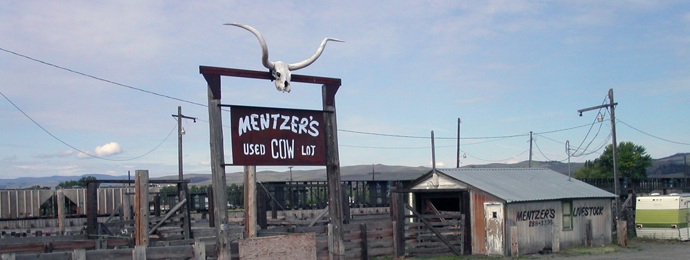
Dorsey Foultz likely sought refuge among people he believed to be sympathetic to his plight but he also might have been attracted to the weekend parties held at the dancing pavilion that Samuel Lytton built. By the turn of the twentieth century, Washington newspapers were reporting on crimes involving liquor and assaults stemming from the large number of people flocking to Lyttonsville for Fourth of July celebrations and lesser events where music and dancing occurred.[14]
The large number of people assembling in Lyttonsville and the stigma attached to the community by whites in Montgomery County likely contributed to its acquisition of the racist sobriquet “Monkey Hollow.” The name first appears in Washington newspapers in 1900 and is usually followed by, “a negro settlement not far from Linden.”[15]
The name “Monkey Hollow” became fixed in the minds of white Montgomery County residents to the point where in 1910 it was used to describe the community in U.S. Census population schedules. In 1928 a Lyttonsville resident was arrested and the Washington Post wrote, “Isaac Young, 46, colored, of Monkey Hollow, near Silver Spring, was remanded to jail.”[16] The name persisted well into the twentieth century. In interviews with journalists after the release of the movie Rocky, former Silver Spring resident Sylvester Stallone frequently described the area near his home as “Monkey Hollow.”[17]
“It wasn’t a very nice name,” lifelong Lyttonsville resident Charlotte Coffield told me in 2016. “And the kids who grew up, the white kids grew up thinking that that was the official name of the community.” She then explained, “On Johnny Carson’s show one evening, he spoke about going – he went to school in Montgomery Hills and he talked about, he said it’s right close to Monkey Hollow, down the street there. So on national TV. So that’s all that he knew, you know.”

Map illustrating U.S. Postal routes in Montgomery County, 1911. Shaded area indicates Lyttonsville area.

“Lyttonsville.” Washington and vicinity, Maryland, District of Columbia, Virginia. United States Geological Survey, 1917.
By 1900, the community now known as Lyttonsville was described variably as “Linden” (for the nearby B&O Railroad station) and “Littonville.” By the end of the first decade in the twentieth century, the name Lyttonsville began appearing in maps and some legal instruments. In 1914, for example, the “Trustees of Lyttonsville School,” a group of residents that included Tandy Scott, Charles Leon Bullock, and Charlotte Coffield’s grandfather, Simeon Deloatch, bought a lot in the Pilgrim Church Tract for their school, which later became known as the “Linden Colored School.”[18] A decade later, Deloatch bought the lot where he and his family had been renting a home. The deed conveying the property to Deloatch noted that he was a resident of “the Village of Littonsville.”[19]
There are hints that the people who lived in the small hamlet had other names for it as well. There was Samuel Lytton’s “Butler’s Park,” for instance. In 1922, Landon Cabell Williamson sold a parcel to a group of Lyttonsville residents calling themselves ‘The People’s Co-operative League of Linwood, Maryland.”[20]
CONCLUSIONS
Montgomery County planners have closed the door on additional research into Lyttonsville’s history and have set into motion plans that will eradicate the last tangible tie that the community has to its past: the Talbot Avenue Bridge. No additional research into the hamlet’s earliest history was recommended despite the substantial gaps in knowledge acknowledged in the 2017 Greater Lyttonsville Sector Plan and the many errors exposed in this brief article. M-NCPPC staff wrote about future historic preservation objectives in the community, “Evaluate 20th-century resources in the Sector Plan area.”[21]
It is clear from the information presented here that much more work needs to be done to accurately document Lyttonsville’s early history. The historical research done by consultants to the State of Maryland to comply with Section 106 of the National Historic Preservation Act as part of the Purple Line Environmental Impact State is incomplete, at best, where Lyttonsville is concerned. Historic preservation planners in the Maryland-National Capital Planning Commission clearly missed many opportunities to accurately and fully identify and evaluate historic resources in Lyttonsville. The people of Lyttonsville and Montgomery County deserve better than what we’ve been given.

Greater Lyttonsville Sector Plan, p. 28.
NOTES
[1] “Historic Context,” Maryland-National Capital Park and Planning Commission, “Greater Lyttonsville Briefing Book” (Silver Spring, Maryland: Maryland-National Capital Planning Commission., Montgomery County Planning Department, May 2014), 2.
[2] Maryland-National Capital Park and Planning Commission, “Greater Lyttonsville Sector Plan” (Silver Spring, Md.: Maryland-National Capital Planning Commission., Montgomery County Planning Department, July 2016), 26–28.
[3] Montgomery County Land Records, Liber JGH 2, folio 33.
[4] Montgomery County Land Records, Liber JA 18, folio 155.
[5] “Work of a Condemnation Jury,” Washington Evening Star, May 16, 1891; “A Jury of Condemnation,” Washington Evening Star, May 31, 1891.
[6] Montgomery County Judgement Book JA 6, pp. 473-477. All of the Metropolitan Southern’s transactions were summarized in a 1988 Quiclaim deed transferring the assets from the defunct Metropolitan Southern Railroad Company to CSX Transportation, Inc. Montgomery County Land Records, Liber 8613, folio 497.
[7] Montgomery County Register of Wills, Docket GCD 1, folio 40.
[8] “Agents Wanted,” The Baltimore Sun, April 18, 1891; “Robbed of $840,” The Baltimore Sun, February 8, 1893.
[9] “Masonic Rites Today for L. C. Williamson: Services for Lawyer, Who Died Tuesday, Will Be Held at 2:30 o’Clock.,” The Washington Post, July 6, 1922.
[10] Montgomery County Land Records, Liber JA 34, folio 15 and Plat Book 1, folio 39.
[11] “Fugitive Dorsey Foultz,” Washington Evening Star, September 14, 1897.
[12] “History,” The Pilgrim Baptist Church, n.d., http://pbc-ss.com/our-history.html. Montgomery County Land Records, Liber JA 32, folio 296, Pilgrim Baptist Church at Linden mortgage, July 26, 1892.
[13] “Fugitive Dorsey Foultz.” Montgomery County Land Records, Liber 218, folio 305.
[14] “Prettyman Dies Of His Wounds,” The Sun (1837-1991); Baltimore, Md., July 17, 1906; “HIST! Dorsey Foultz: Detective Barbee Sees Negro Murderer in a Dream. Tells of Long, Hard Chase,” The Washington Post (1877-1922); Washington, D.C., September 7, 1909.
[15] “Colored Man Charged with Murderous Assault Held for Grand Jury,” Washington Evening Star, June 23, 1903; “Robbed a Store,” The Evening Times, March 2, 1900.
[16] “Bethesda Citizens Seek Franchise for Bus Line,” The Washington Post; Washington, D.C., February 22, 1928.
[17] Judy Klemesrud, “‘Rocky Isn’t Based on Me,’ Says Stallone, ‘But We Both Went the Distance,’” The New York Times, November 28, 1976.
[18] Montgomery County Land Records, Liber 246, folio 432.
[19] Montgomery County Land Records, Liber 379, folio 371.
[20] Montgomery County Land Records, Liber 312, folio 248.
[21] Maryland-National Capital Park and Planning Commission, “Greater Lyttonsville Sector Plan,” 31.
© 2017 D.S. Rotenstein
Shortlink for this post: https://wp.me/p1bnGQ-33R
David, Thank you so much for your in-depth history of the area my family has resided in for over 47 yrs. We were the first family to move into the then new(1971) Friendly Gardens Apartments on Lyttonsville rd. Would there be a place I might look for the last 80 or so years, to current? Brilliant history, thank you so much for your efforts toward what appears to be a great love of your life. Steve Van Landingham, Former resident
In about 1962, when I was a teenager, my parents bought a house at 1956 Seminary Road from the Stallone family, Sylvester’s parents. Previously we had lived in an apartment complex on Ross Rd., not far away. The apartment complex was immediately adjacent, as I recall, to a large sort of wild area that I think was a garbage dump for Montgomery County. Near that was also what I can only call a “compound” of extremely modest ramshackle houses off Brookville Rd. apparently occupied only by African Americans. The area looked poverty-stricken to me. At some point I was told that the area was called Lyttonsville. I was told that it stood on land that was formerly part of the Grubb Plantation. I was told that upon emancipation that parcel of land was given on a rent-free 100 year lease to former slaves on the plantation. The lease was to expire around 1965. I assumed the people who lived there in the 1960s were descendants of the original lessees. It appears from this article that most of what I had been told is wrong, I don’t remember hearing the name Monkey Hollow, but I do remember hearing Montgomery Hills being called Monkey Hills. At Montgomery Hills Junior High, not far at all from the black community, there were very few black kids, but I was acquainted with one kid, named Willie Crutchfield, who I believed lived in the compound.
I had also heard of a 100 year covenant that expired in 1965. I heard that if the original families maintained a home on the property for 100 years it would become their. After that county made significant improvements. I thought perhaps it was private property until then …
I recently replied to a query, on a neighborhood website, asking if anybody knew what was originally on the triangle property NE corner of Brookville Road and Warren. In 1977 there was a dilapidated barn in the middle of heavy overgrowth. I went on to say that I recalled what seemed to be a black community in the vicinity of the Annex on Brookville Road. It was in the process of being razed and the hillside that contained the cemetery was being re-contoured. I believe there is now a motorcycle sales shop on the site. My curiosity was piqued by the memory and I started doing an internet search to see if I could find any more information on this “ghost” community. There seemed to be very little out there until I found this excellent piece of research. Thank you so much for your effort, documentation and clarity of writing. I am 74 and you have removed one more “bucket” from my list.
Mike Graham on Monroe Street
Who were the ancestors of Samuel Lytton/ Litton?