This is the first post in a series: Courtyards of Convenience: Montgomery County’s Eruvim
Blues guitarist Buddy Guy frequently tells interviewers that when you stretch a string, you are stretching a life. When Orthodox Jews stretch a string to build an eruv, they are creating a community. Eruv is a Hebrew word and in English it means “to mingle.” An eruv is symbolic space created by Orthodox Jews to enable them to carry and push things on the Sabbath as they move around their neighborhoods and travel to and from synagogue. Rabbinic law, Halakhah, prohibits Jews from working on the Sabbath. This includes carrying such items as house keys; pushing baby carriages and strollers; driving; playing ball; walking dogs on leashes; and, using medical devices like canes and walkers. and, carrying rain gear.

Silver Spring eruv. Constructed post (lechi) and string along the Capital Beltway. Photograph by David Rotenstein, October 2010.
Located in the Washington, D.C., suburbs, Montgomery County, Maryland, has six seven eruvim (the Hebrew plural for eruv) and they cover nearly 40 square miles in the down-county area. An additional approximately 3.2 miles is covered by the Northwest Washington/Chevy Chase eruv which is located mainly in the District of Columbia.
The boundaries are marked mainly by existing structures: utility poles and lines; fences; walls; and, sound barriers along the Capital Beltway. The eruvim perimeters cut through residential neighborhoods and commercial districts and they traverse horse pastures and rural roads through all of Montgomery County’s urban, suburban, and rural landscapes. Click here to see all of Montgomery County’s eruvim in Google Maps.
Over the past few millennia Jews have found creative ways to circumvent religious law. Folklorist Alan Dundes wrote The Shabbat Elevator and other Sabbath Subterfuges (2002, Rowman & Littlefield Publishers, Inc.), an amusing study of the ways Jews around the world have created rules to ease the many religious restrictions imposed during the Sabbath. One of those inventions was the creation of eruvim. Eruvim expand the boundaries of usable space on the Sabbath by enabling entire families — the old and young, men and women — to worship together without violating Jewish laws that otherwise would restrict their movements to personal domestic spaces.

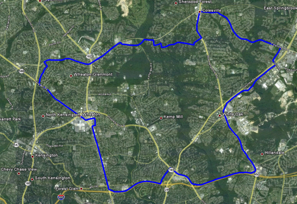
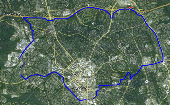
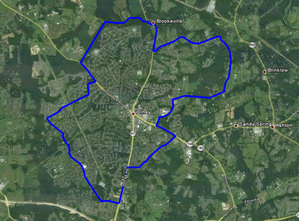
Montgomery County, Maryland, eruvim. October 2010. Note that the boundaries were mapped in 2010-2011 and may not reflect current eruv boundaries.
Montgomery County’s eruvim were built, and are monitored and maintained, by groups of volunteers in Orthodox congregations. The county’s six seven eruvim are the Silver Spring eruv, Olney eruv, Woodside eruv, Aspen Hill eruv, Potomac eruv, and Bethesda eruv.
The Silver Spring Eruv Association, which is based in Kemp Mill’s Young Israel Shomrai Emunah, is responsible for the approximately 13.75-square mile eruv that enframes an area from the Beltway to Randolph Road and from Georgia Avenue to New Hampshire Avenue. This is Montgomery County’s largest eruv and anecdotal evidence suggests that it also is the oldest (built in the late 1970s).
The 4.2-square-mile Woodside eruv is managed and monitored by the Woodside Synagogue Ahavas Torah. Like the Silver Spring eruv, the Woodside eruv uses the Beltway as a boundary and it extends south to the District of Columbia line where it is met by the Northwest D.C. eruv. It includes all of downtown Silver Spring and the suburban subdivisions that sprouted during the mid-twentieth century.
The Olney eruv covers approximately seven square miles. It is bisected by Georgia Avenue and it includes subdivisions and a horse farm. This eruv was built by the Ohev Sholom Talmud Torah Congregation.
The Bethesda eruv was built by Congregation Beth El. Its 1.9-square-mile area includes portions of Bethesda west of Wisconsin Avenue and north of Bradley Boulevard, including the National Institutes of Health and Suburban Hospital.
The Potomac eruv stretches from the Montgomery Mall and I-270, along Democracy Boulevard, and through subdivisions to the west. Covering approximately 5.3 square miles, this eruv was built by the Beth Sholom Congregation & Talmud Torah.
Built and maintained by the Beth Joshua Congregation, the Aspen Hill eruv covers approximately 3.5 square miles west of Georgia Avenue and between Norbeck Road to the north and Veirs Mill Road to the south.
The Rockville/North Bethesda eruv is maintained by the Congregation Ezras Israel of Rockville. It covers approximately 3.6 square miles and it includes the heavily developed Rockville Pike corridor and suburban developments along Montrose Road, Old Georgetown Road, and Tuckerman Lane.
There are three types of eruvim defined under Halakhah: eruv hatserot (courtyards), eruv thumim (distance), and eruv tavshilin (cooking). Each eruv creates a symbolic or ritual space within which certain activities, like carrying, may occur during the Sabbath. Montgomery County’s eruvim are courtyard eruvim, i.e., they turn large areas of suburban and urban neighborhoods into one large domestic courtyard within which an entire community collectively shares the enclosed space.[1] The other types of eruvim permit walking long distances on the Sabbath and the preparation of a Sabbath meal in advance.
Montgomery County’s eruvim are among the more than 130 eruvim throughout the United States.[2] Nearby eruvim include the expansive Kesher Israel eruv which covers much of downtown Washington, D.C., and includes within its boundaries the White House, Capitol, and Supreme Court buildings; the National Synagogue’s Northwest Washington eruv which abuts southern Montgomery County; and, the University of Maryland eruv. There are eruvim in the Deep South, the Midwest, the Rockies, and California, in addition to eruvim in large eastern cities like Baltimore, Philadelphia, New York, and Boston.
Jewish studies scholars debate whether the first eruvim appeared during King Solomon’s reign, approximately three thousand years ago, or whether they date to the fourth century CE.[3] Although eruvim have a long history, they became widespread among modern urban Jewish populations after the 1960s.[4]
In order to build an eruv that meets all of the requirements of Jewish law, several conditions must be met. An eruv must enclose an area measuring at least 12 feet square and there must be suitable natural topographic features and cultural elements present to make a valid perimeter. Jewish law requires that eruvim be sanctioned by local governments and there are limits to the number of people — 600,000 — who may live within a single eruv’s boundaries.
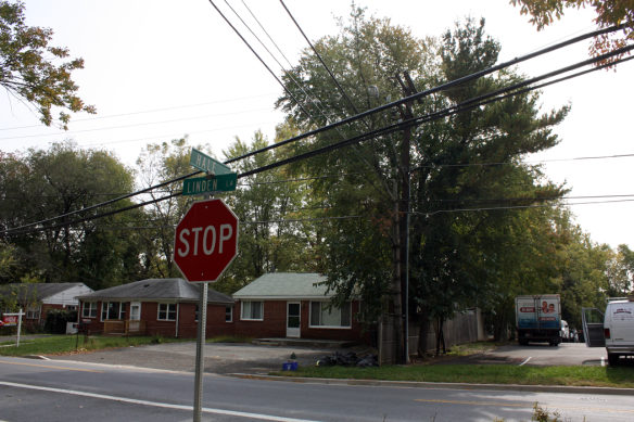
Eruvim are at once visible to the observant Jews who live in them and invisible to others. While signs and complicated maps delimit the boundaries for individual eruvim, markers along the perimeter reinforce the sacred space within versus the secular space on the outside. Sometimes these markers are as simple as strips of plastic molding applied to utility poles in public rights-of-way. Known as lechi, these symbolically represent the vertical posts in a doorway and the cables/wires are the lintels or korah. The Greater Boston Eruv Corporation has a useful glossary of eruv terms and the next post in this series will include an illustrated guide to eruv architecture.
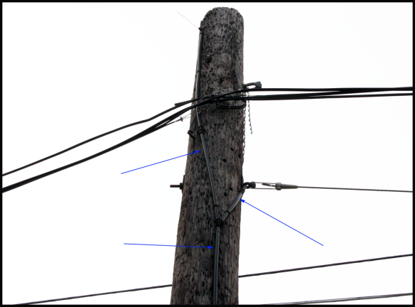
Silver Spring eruv. Lechi attached to a utility pole along eruv boundary in Wheaton. Photograph by David Rotenstein, October 2010.
The information age has transformed the way Jews map their eruvim. Once confined to word of mouth descriptions and paper maps, now Orthodox congregations are creating Internet-based maps that are both static, i.e., a simple image file or PDF, and dynamic using Google Earth and other GIS-based technologies.

Eruv boundary sign, New York.
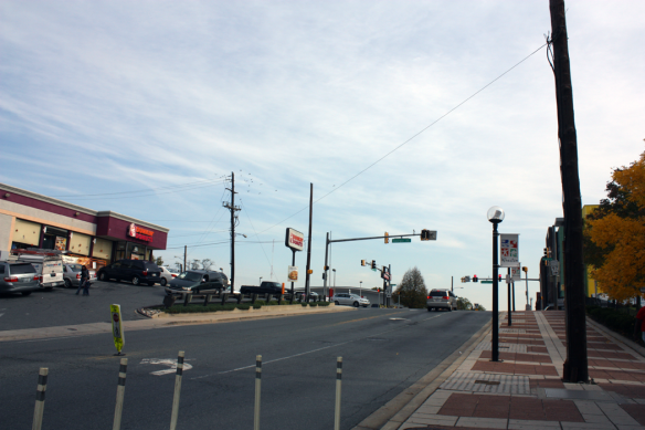
The spaces enclosed by Montgomery County’s eruvim are diverse. In Wheaton and Silver Spring, eruvim pass through and enclose busy commercial areas en route to quiet suburban streets.
Along the Beltway’s inner and outer loops, the Silver Spring and Woodside eruvim connect to sound walls by specially constructed lechi and string.

Silver Spring eruv. String travels along wood posts (lechis) to the Beltway sound barrier. Photograph by David Rotenstein, October 2010.
Olney’s eruv leaves paved roads and subdivisions as it passes through a horse pasture and woods in the spaces between rapidly developing communities.
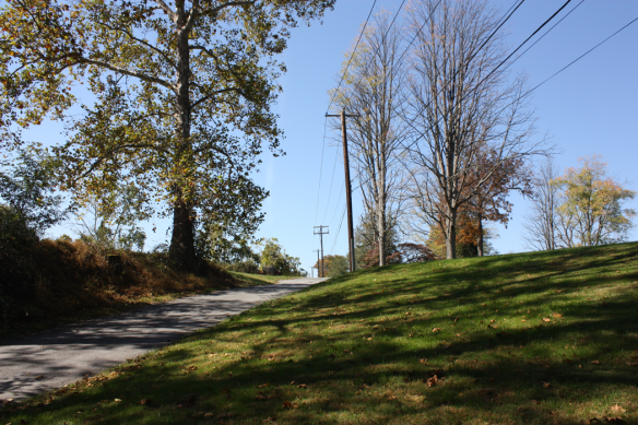
The Olney eruv as it travels away from Georgia Avenue along an unsurfaced farm drive. Photograph by David Rotenstein, October 2010.
In subsequent posts in Courtyards of Convenience: Montgomery County’s Eruvim, I will be writing about how eruvim are built and maintained in Montgomery County and elsewhere:
- Mapping Montgomery County’s Eruvim (this post)
- A chance encounter with an eruv inspector (October 22, 2010)
- Making the symbolic real: Building and maintaining the eruvim (October 27, 2010)
- Life inside the Eruvim (December 8, 2010)
- Eruvim in the Information Age
The next post in this series looks at eruvim as artifacts in cultural landscapes and takes up the characteristics of eruvim and how they are built.
If you have information on Montgomery County’s eruvim, I’d like to hear from you. Please leave a comment or email me directly at: ![]()
© 2010 David S. Rotenstein
NOTES
[1] Charlotte Elisheva Fonrobert, “The Political Symbolism of the Eruv,” Jewish Social Studies 11, no. 3 (2005): 9-35.
[2] Alexandra Lang Susman, “Strings Attached: An Analysis Of The Eruv Under The Religion Clauses Of The First Amendment And The Religious Land Use And Institutionalized Persons Act” (2009).
[3] Peter Vincent and Peter Warft, “Eruvim: Talmudic Places in a Postmodern World,” Transactions of the Institute of British Geographers 27, no. 1 (2002): 30-51.
[4] Davina Cooper, “Talmudic Territory? Space, Law, and Modernist Discourse,” Journal of Law and Society 23, no. 4 (1996): 529-548.
Shortlink for this post: https://wp.me/p1bnGQ-mp




David- This is fascinating. I knew that Orthodox Jews walked to shabbat services and tried to live near the shul. In many towns in NJ and Pa, you see this in action. But I did not realize there was a formal boundary. It obviously is a TCP and it is interesting how you are documenting it. I am interested in learning more about the archaeological expressions of Jews in the diaspora.
Thanks for this fasciniating series of posts. Great info and multimedia reporting. Lived in the area all my life and never knew about this interesting phenomenon.
There is at least one more eruv in Montgomery County serving Rockville / North Bethesda. I don’t believe a map of it exists online, but a map of it can be found in “The Good Book” (phone directory listing Orthodox Jewish households in Greater Washington). Rabbi Kreiser of Cong. Ezras Israel is the Rav Hamachshir and it serves Ezras Isreal, Magen David, Aish, and the JCC campus. Rough boundaries are: 270 – Montrose – diagonal connecting Montrose/Tildenwood to 355 at Congressional Plaza – 355 – 495.
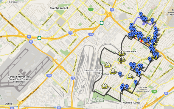
Eruv map outlines on Google Maps along with homes for sale inside Lower Montgomery County Eruv.
Shame that this doesn’t include PG County’s lone eruv, around College Park…
The original 2010 post was about “Montgomery County.”