
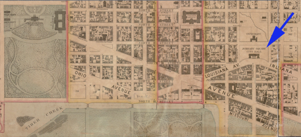
Washington City Hall, c. 1857. Adapted from the Map of the City of Washington by A. Boschke, Library of Congress image.
Shortlink for this post: https://wp.me/a1bnGQ-ZH
Washington City Hall, c. 1857. Adapted from the Map of the City of Washington by A. Boschke, Library of Congress image.
Shortlink for this post: https://wp.me/a1bnGQ-ZH