
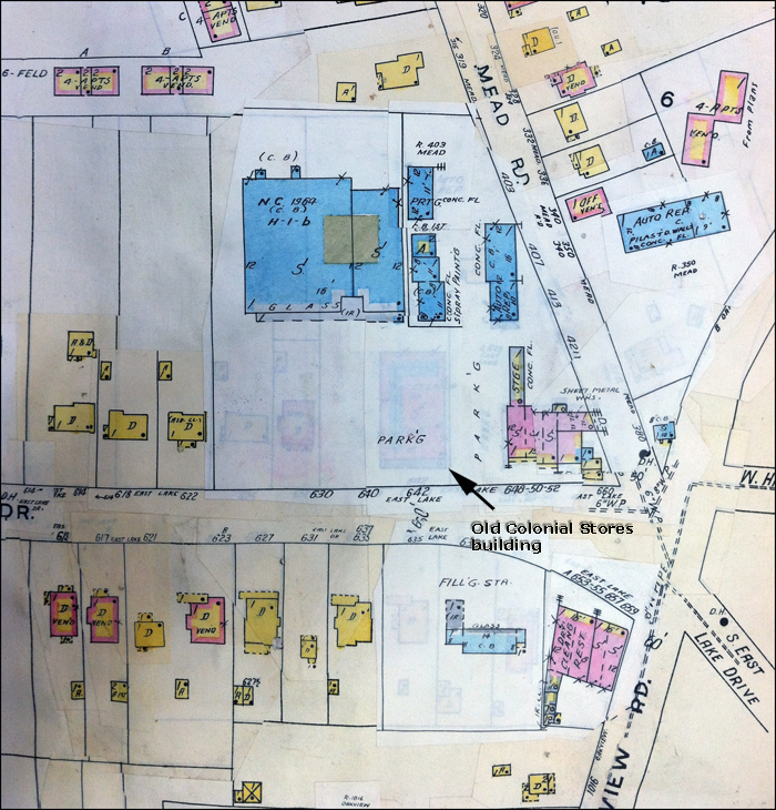
Fire insurance map (c. 1964) showing the rebuilt Colonial Stores footprint. If you look closely at the area pasted over after 1964, you can see the old post-World War II store site beneath the parking area. Original in the DeKalb History Center.
Shortlink for this post: https://wp.me/a1bnGQ-1bj