
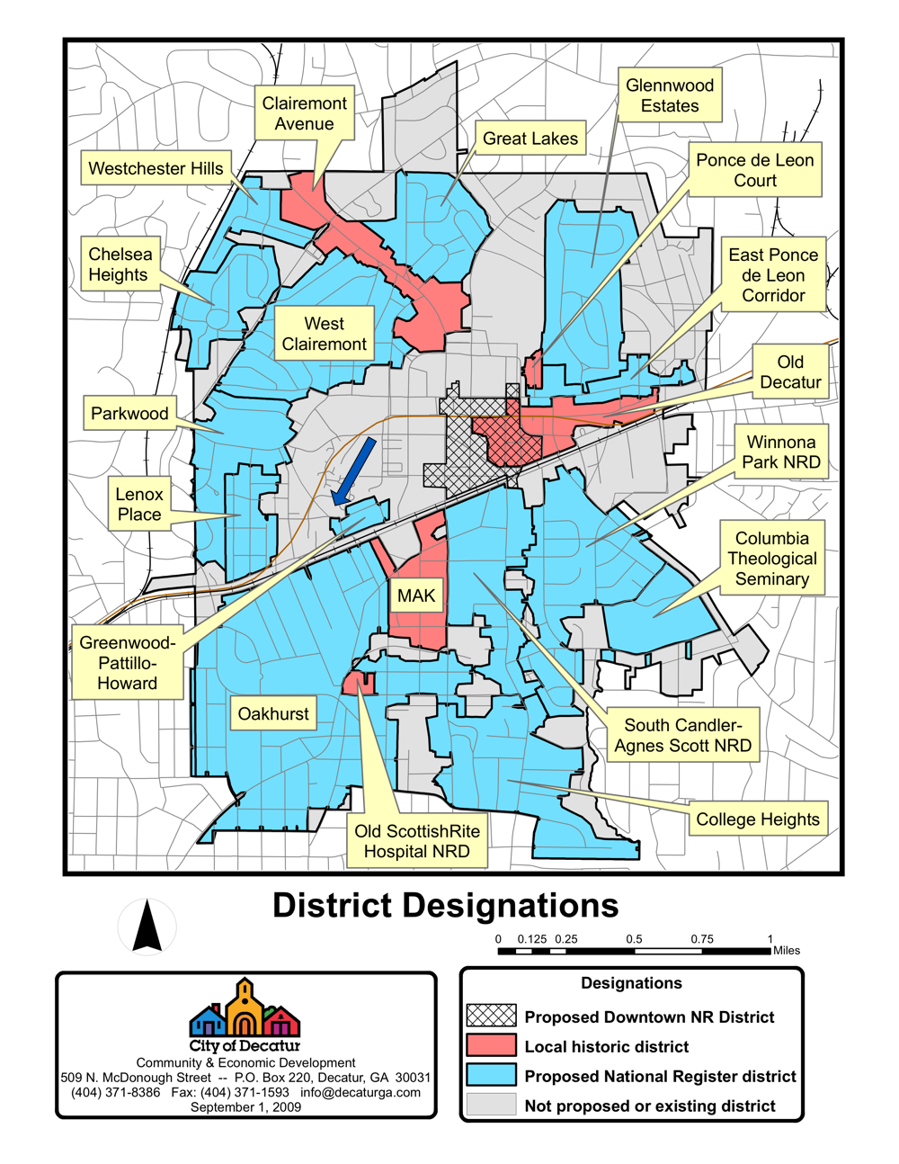
Overview map from the City of Decatur’s 2009 citywide historic resources survey. The arrow indicates the former Antioch church location. Credit: City of Decatur.
Shortlink for this post: https://wp.me/a1bnGQ-2rp
Overview map from the City of Decatur’s 2009 citywide historic resources survey. The arrow indicates the former Antioch church location. Credit: City of Decatur.
Shortlink for this post: https://wp.me/a1bnGQ-2rp